Hometown Parade
Parade Route Map
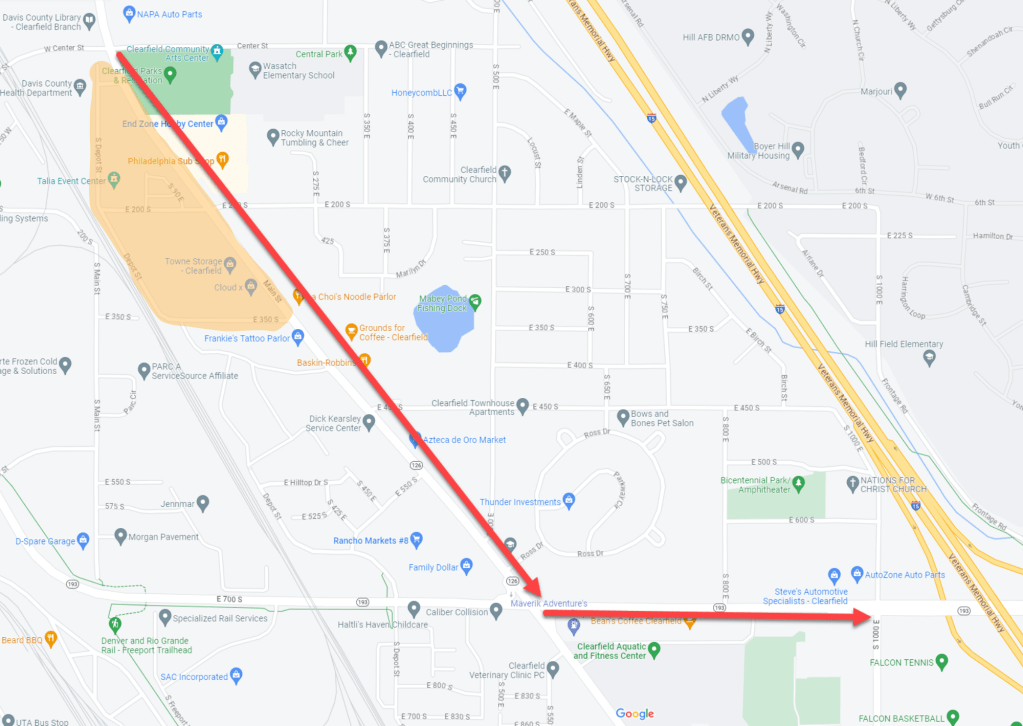
This is the map for the Hometown Parade on July 4th at 9:30 a.m. The route begins at City Hall, goes down State Street, and up SR-193 to the high school. We ask that you wait until the night before (Friday @ 5 p.m.) to set up blankets and chairs at CITY HALL for the parade, fireworks, and festival spots. ***Tarps and stakes are not allowed***
There will be no outlet between 350 S. and Center St. from 9 a.m. on July 4 until the parade concludes. If you live in the orange area on the map, please plan accordingly.
The north parking lot at City Hall will be closed due to float hosting. The CHS parking lot will be closed due to construction and float hosting.
Freedom Festival
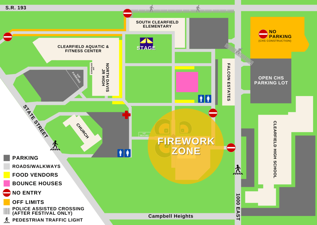
This is the map for the Freedom Festival at Fisher Park. There will be food vendors by the junior high, bounce houses, and walking paths through the middle of the park for your convenience and in the event of an emergency for our first responders. Please do not sit in the walkways.
Please DO NOT set up and blankets and chairs in the area until 11 am on the 4th of July so our crews can fully clean up from the parade and prepare for the festival.
Additional parking is at CHS, Rancho Markets, the Clearfield City Cemetery, Bicentennial Park, Nations for Christ, and the LDS Church north of Fisher Park across SR-193.
The northern portion of the CHS parking lot will be closed due to construction.
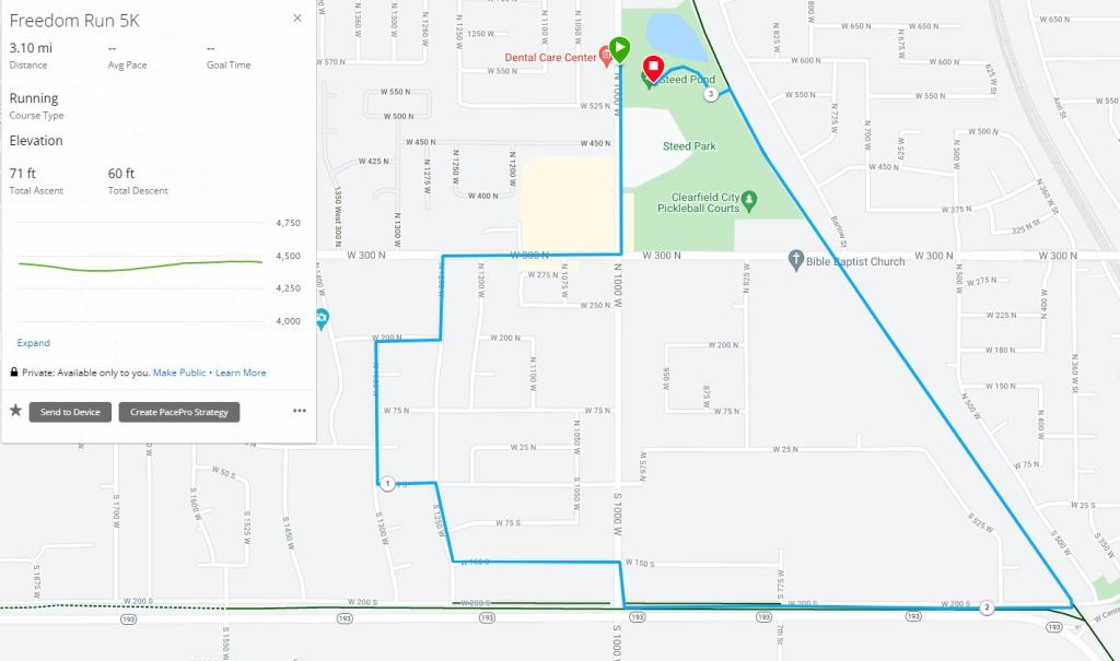
Freedom Run
5k Run
Register by June 12 to be guaranteed a shirt. Early registration is $20 or $25 day of.
1000 W from 525 N to 300 N as well as 300 N from 1500 W to 700 W will be closed to traffic at the beginning of the race.
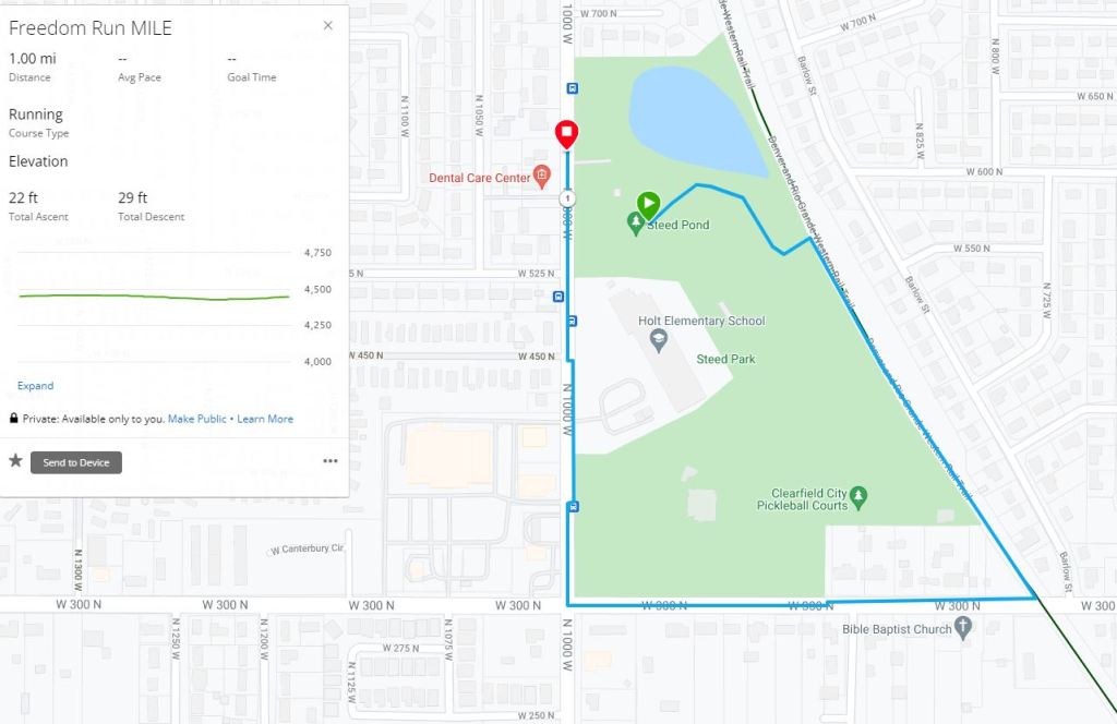
Freedom Run
1 Mile Walk
Register by June 12 to be guaranteed a shirt. Early registration is $20 or $25 day of.
1000 W from 525 N to 300 N as well as 300 N from 1500 W to 700 W will be closed to traffic at the beginning of the race.
